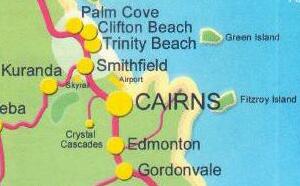
(Return to "Cairns
and Trinity Beach" albumn)
Thursday 20th April
2006
Cairns
......and it's flooded!!!
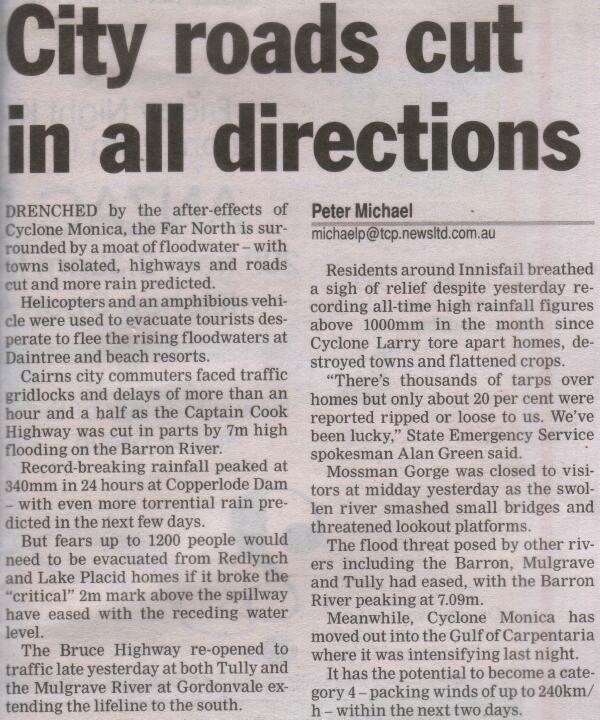
As a result of Cyclone
Monica crossing the coast to the north of the city,
Cairns received "an unbelievable amount" of rain!!!
There was extensive
flooding around Cairns
and the photos below show some of the roads and areas
in our part of the Tropical North!!!
(this page includes newspaper
reports and a number of photos
and it may take a few extra seconds to download completely)
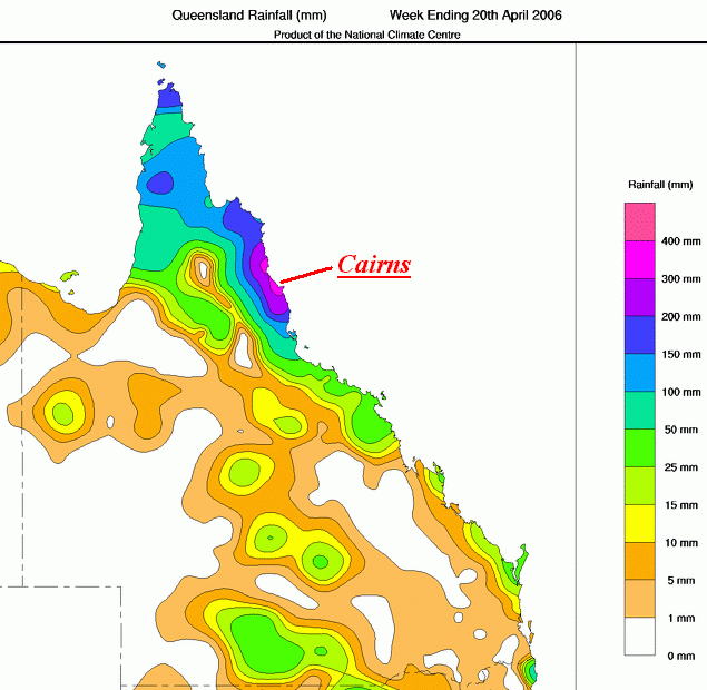
Rainfall Map - and Cairns
was right in the centre of the heaviest falls!!!
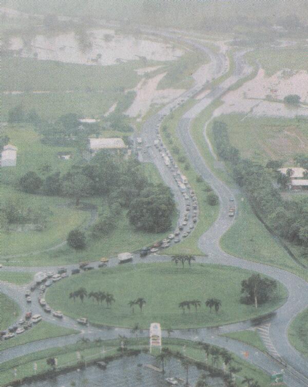
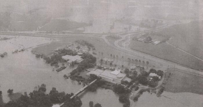
At the bottom of the
photo is the Smithfield Shopping Centre car park
The main access to Cairns is off to the left at the top of this
shot
and this was cut in numerous places by the floodwaters
The alternative route is to the right at the Caravonica roundabout
This shot shows the
Caravonica roundabout with the alternative access road to the
right
The main highway to Cairns is across the top of the photo
The tourist-attraction Skyrail buildings are in the foreground
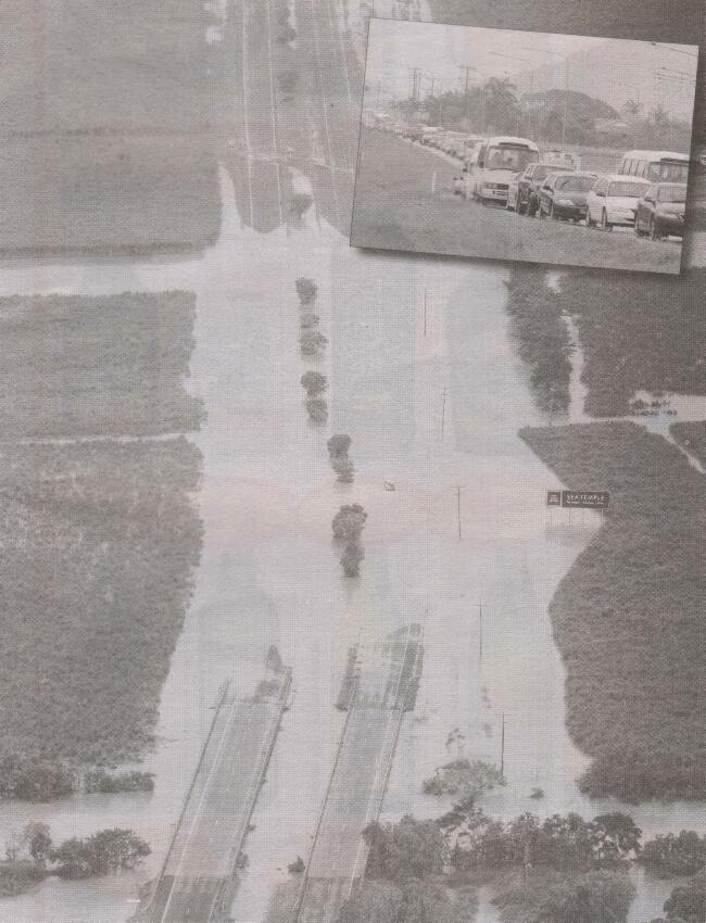
The main highway is
cut!!!
This photo was taken near Holloways Beach
The insert shows the traffic
caught up trying to use the alternative access route through Caravonica
As well as all the traffic, a few minor accidents added to the
problems
Sharon left for work at 8.00am - not realising the mess on the
roads!!!
After about an hour, she was able to turn around, come home,
and go in a few hours later
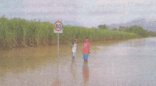
The Yorkeys Knob access
road